
Directions to all of our meet locations and offices. Use the navigation above to select the location you need directions to.
Durango Office
Meet Point For:
- Lower Animas River
- Upper Animas River
- La Plata Canyon Jeep Tours
Durango Office Address: 50 Animas View Drive, Durango, Colorado 81301
Google Maps Directions to Our Durango Office
Coming from downtown: Head north on Main Street. After you pass City Market and 32nd Street, go another 6 blocks and Animas View Drive will be on the right side of the road. You will be able to see our building and buses from Main Street.
Coming from the north: Head south on highway 550 towards Durango. When you get to Durango you will pass the Iron Horse Inn on the left, continue about another 1/2 mile and you will see Animas View Drive on the left. We are the first building on the right with all of the big white buses.
Moab Office
Meet Point For:
- Castle Valley
- Cataract Canyon
- Moab Jeep Tours
- Desolation Canyon (night prior to Redtail flight)
Moab Office Address: 745 Kane Creek Blvd, Moab, Utah 84532
Google Maps Directions to our Moab Office
Coming from South Main Street: Head north on highway 191 until you see the McDonald’s on the left, there you’ll turn left onto Kane Creek Blvd. Follow it for a little over a mile until you see the Mild to Wild flags on the left.
Coming from North Main Street: Head south on highway 191 until you see the Express 24 gas station on the right. Turn right onto 5th W Street. At the end of the street, turn right onto Kane Creek Blvd, and you’ll soon see the Mild to Wild flags on the left.
If You Need a Ride to our Moab Office:
We do not provide shuttle services to our Moab Office, but check out these options below and be sure to book them in advance before your trip!
Porcupine Shuttle
- Located 20 mins from Moab Office
- Custom Requests
- Airport shuttles
- Hotel Pick-up/Drop-off
- Trailhead/put-in/take-out shuttles
- 435-210-0896
- https://porcupineshuttle.com/
Roadrunner Shuttle
- Trailhead/put-in/take-out shuttles
- Airport shuttles
- Hotel Pick-up/Drop-off
- 435-260-2724
- https://www.roadrunnershuttle.com/
Moab Taxi
- Shuttles within 250 miles of city of Moab
- Trailhead/put-in/take-out
- Airport shuttles
- Hotel Pick-up/Drop-off
- 435-210-4297
- https://moabtaxicab.com/service.htm
Arkansas River
Meet Point: 40671 US-24
Google Maps Directions to Our Buena Vista Office
Our Buena Vista office is conveniently located in the heart of the Arkansas River Valley, just about 2 hours southwest of Denver and a little over an hour from Summit County. We do share a lot with another outdoor company, so make sure to look for the “Mild to Wild” signs!
From Denver (about 120 miles): Head west on I-70, then take US-285 South toward Fairplay/Buena Vista. Merge onto US-24 West/North toward Buena Vista. Our office will be on your left, located just north of downtown.
Clear Creek
Meet Point: 431 Chicago Creek Rd
Google Maps Directions to Our Durango Office
Our Idaho Springs office is conveniently located near Denver, just 30 minutes west on I-70, and less than an hour from Summit County. We do share a lot with another rafting company, make sure the find the “Mild to Wild” signs!
From Denver (about 30 miles): heading west on I-70, take exit 240 in Idaho Springs and turn left. Our office will be on the left in about 0.5mi.
Upper Colorado
Meet Point: Rancho Del Rio Campground
Address: 4199 Trough Rd, Bond, CO 80423
Google Maps Directions to Our Upper Colorado/Kremmling Meet Point
Our Upper Colorado/Kremmling meet point is located right on the river at the historic Rancho Del Rio resort, roughly 2.5 hours northwest of Denver and just over an hour from Summit County. Because we operate out of a bustling campground, keep your eyes peeled for the “Mild to Wild” signs or vehicles!
From Denver (about 125 miles): Head west on I-70 to Silverthorne (Exit 205). Go north on CO-9 for approximately 33 miles toward Kremmling. Just before entering Kremmling, turn left (west) onto Trough Road (Grand County Road 1/Colorado River Headwaters Scenic Byway) and follow the river for 19 miles. Rancho Del Rio will be on your right.
San Miguel River
Meet Point: Caddis Flats Campground
Caddis Flats Address: Off CO 145, about 2 miles west from Placerville, Colorado.
Google Maps Directions to Caddis Flats Campground
From Placerville (about 15 miles from Telluride): At Jct. CO 145 & CO 62, go west on CO 145 1.8 miles. Entrance is on the left (south).
From Norwood: Go east on CO 145 about 16.5 miles. Entrance is on the right (south).
Telluride Jeep Tours
Meet Point: Shandoka Bus Stop
Google Maps Directions to Our Telluride Meeting Location
Our Telluride Jeep Tours meeting point is conveniently located right in the town of Telluride at the Shandoka parking lot and bus stop. We operate our tours out of this central transit hub, so please make sure to look for our open-air “Mild to Wild” custom safari vehicles and guides!
From Mountain Village (about 7 miles): Head down the mountain on Mountain Village Boulevard, turn right onto CO-145 North, and then take a right into the town of Telluride via Colorado Avenue. Turn right onto Mahoney Drive, then left onto West Pacific Avenue to access the Shandoka parking area.
Piedra River
Meet Point: Forest Rd. #622
Piedra River Put In Address:
Google Maps Directions to Piedra River Put In
From Durango: Leave town on U.S. 160 East for approximately 40 miles, you will cross the Piedra River and turn left on Forest Rd. #622 (First Fork Road). Drive down this dirt road for one mile. Pull out on the left.
From Pagosa Springs: Leave town on U.S. 160 West for approximately 20 miles, just as you reach the Piedra River (do no cross the river) turn right on Forest Rd. #622 (First Fork Road). Drive down this dirt road for one mile. Pull out on the left.
Lodore & Yampa
Meet Point: Microtel by Wyndham in Vernal, Utah
Microtel Address: 1041 S 1500 E, Naples, UT 84078
Google Maps Directions to Microtel by Wyndham
Book Your Stay at the Microtel the night before your Lodore or Yampa River trip.
Silverton Jeep Tours
Meet Point: Eureka Station
Eureka Station Address: Anesi Park, 1239 Blair Street, Silverton, CO 81433
Google Maps Directions to Anesi Park
From the train’s boarding location on Blair Street, walk a ½ block North. Bathrooms and our tour vehicles will be adjacent to the park.
Mesa Verde
Meet Point: Mancos Visitor Center (Not the Mesa Verde Visitor Center)
Mancos Visitor Center Address: 101 Railroad Ave, Mancos, CO 81328
Google Maps Directions to the Mancos Visitor Center
From Durango: Head west on highway 160 for 27 miles. Once in Mancos, turn left on N Main St, then another left on Railroad Ave.
Salt River
Meet Point: Primitive Road
Mild to Wild’s Salt River Location: Primitive Rd, Whiteriver, AZ 85941
Google Maps Directions to the Salt River Put In
From the South on highway 77: Look for the bathrooms on your right (pictured below). You will cross the bridge and see our Mild to Wild sign on your left right after the bridge.

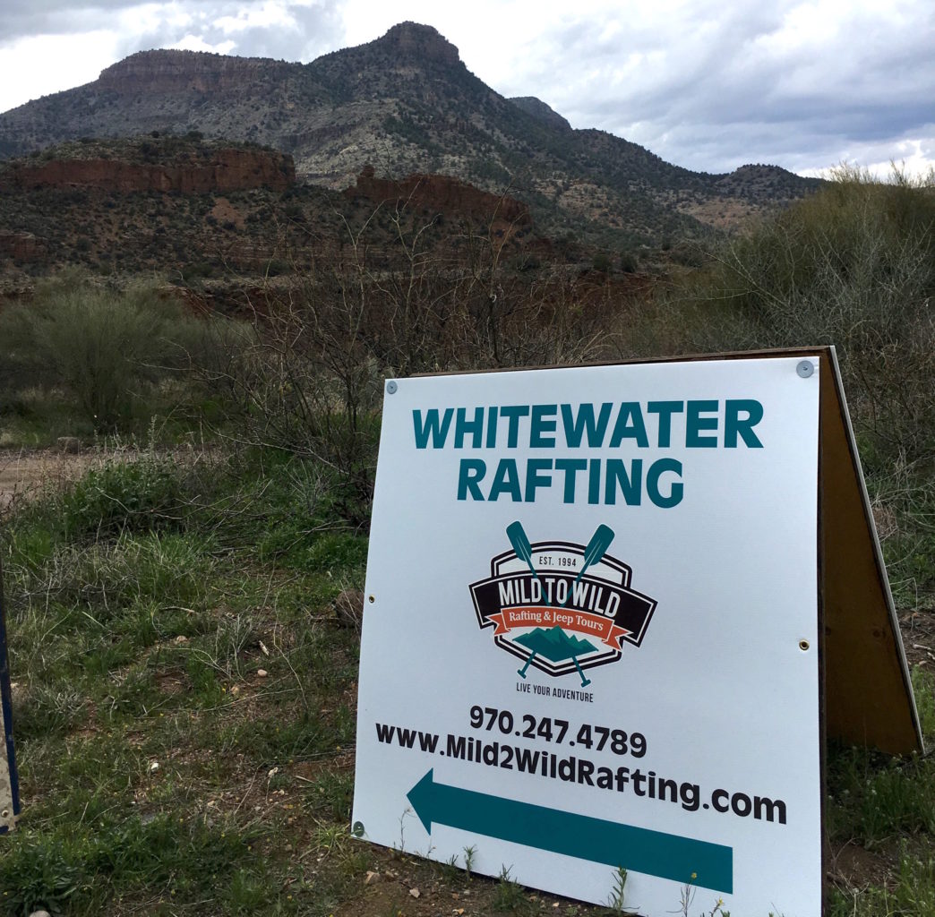
From the North on highway 77: Look for a dilapidated gas station on your left (pictured below). You will see our Mild to Wild sign shortly after on your right.

Dolores River
Bradfield Recreation Site
For Full Day, 2 Day, and 3 Day Ponderosa, and 6 Day Ponderosa/Slick Rock trips
Google Maps Destination Link:
https://goo.gl/maps/LJDq5nTbpezmAEqb6
Coming from Cortez, CO:
(These directions are slightly different from Google for the county road portion— this version just has one less turn.) Time wise consider it half a dozen, 6 of the other!
- Head North on US-491 for 21 miles
- After Pleasant View, turn right onto County Road EE for 1.5 miles
- Turn left onto County Road 16 for 1.7 miles
- Turn right onto County Road S for 1.1 miles
- Turn left onto Bradfield Recreation Road to reach Bradfield Recreation Site
- The river and boat launch will be on the right.
Slick Rock Access Point Directions
For Slick Rock 3 Day trips
- Bring cash for parking! ($10 per day)
- You’ll be able to see the Dolores River from the parking area, just watch for the boats! Your guides will shoot to be there 1- 2 PM.
- See page 2 for directions coming from Cortez
Google Maps Destination Link:
https://goo.gl/maps/MvLQa8E8sazM9uAA7
Coming from Norwood, CO:
- Head Northwest on CO-145 for 16 miles
- Turn left onto CO-141 and head south for 35 miles. Look for the little white house on the right where the turn is. If you drive into Naturita, you’ve gone too far!
- Just after the Dolores River bridge crossing, turn right into the lot where the little building is with the stables. You’ll pay for parking inside, and receive instructions for where to leave your car. Parking is $10 per day.
Coming from Cortez, CO:
- Head North on US-491 for 36 miles
- Head North on CO-141 for 21 miles
- Just before the bridge that crosses the Dolores River, turn left into the lot where the little building is with the stables. You’ll pay for parking inside, and receive instructions for where to leave your car. Parking is $10 per day.