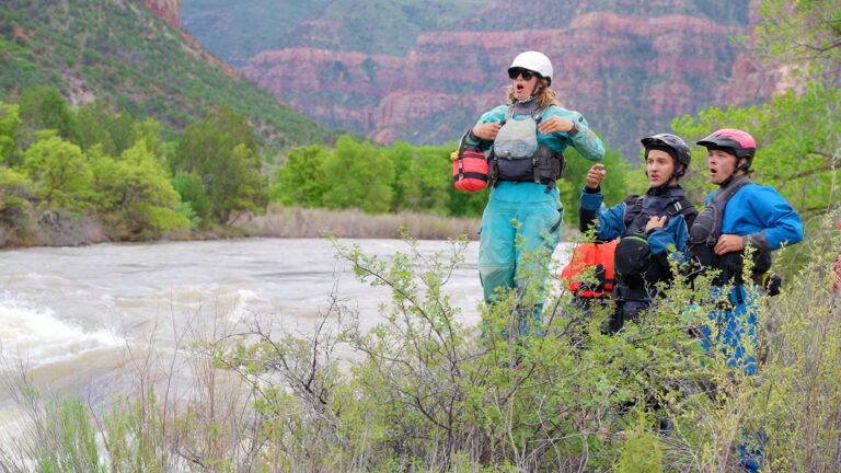
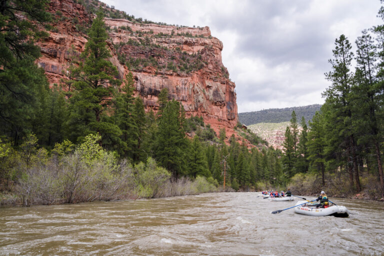
The Dolores River is one of the most coveted rafting trips in the United States. Below the Mcphee Dam, the looming canyon is often quiet, robbed from the rip-roar that once reverberated between its red walls. But every few years, the imposing corridor returns to its riparian roots. Boaters accordingly flock to the born-again banks to rollick in the white water, play in the ponderosas, and admire seldom-seen treasures.
The Dolores receives a lot of attention related to conservation (a necessity that we are incredibly thankful for), but it seems little is often known about its fascinating attributes. With that, here’s a few fun facts about the Dolores River. We hope it inspires you to see this wonderful and rare gem for yourself someday.
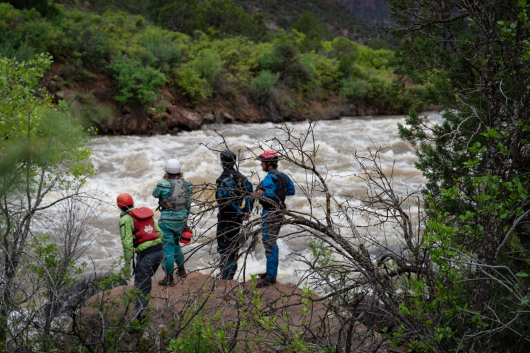
Check Out Dolores River Rafting Trips#1 The Otters are Imported

Out of the gate with the cold hard facts! If you happen to spot an otter on a Dolores River trip, you’re incredibly lucky! The southwestern otter became locally extinct in the region at the start of the 20th century.
Early 19th century fur trappers took out most of the population, and pollution from mines in the 1880s made habitation especially difficult. The last time a native otter was spotted in the area was in 1973.
The BLM and CDOW started introducing otters from Oregon and Alaska in 1988, per Dolores River Boating Advocates. Boaters have often spotted them near the McPhee Dam (most likely for the great bass fishing!) and down through Slick Rock Canyon.
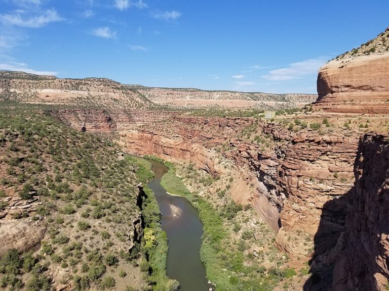
#2 The Second Longest River Canyon in the US
The Dolores River begins its 241 mile journey high in the San Juan Mountains of southwest Colorado. For a reminder— The Grand Canyon 277 miles.
There seems to be some contention around whether the Dolores River is actually the second longest canyon in the US, since the walls of the tributary aren’t always thousands of feet high. Perhaps those who have driven and rafted through its numerous ravines, gorges, and alpine valleys should be the judge.
#3 Home to 5,000 Year Old Art
There is a treasure trove of rock art panels in Gypsum Valley, Slick Rock Canyon, Shaman Cave and Bull Canyon. Many of the works are from the Archaics who lived in the area between 6,500 BCE to 800 CE.
They led a more sedentary lifestyle in comparison to their Paleo-Indian ancestors, and only moved with the seasons. Archaics were understood to camp in higher elevations in the summer to trap game, and in the canyons during the fall to collect nuts, berries and hopefully some scrumptious beetroot. Their petroglyphs and pictographs are widespread across the Colorado Plateau, often found in various remote canyons like those in Dinosaur National Monument.

#4 The Dolores Runs North
Only a small percentage of rivers in the world run north, and the Dolores is one of them! While the entire meander isn’t northbound, more than half of its journey towards the Colorado River is.
The northbound section of the Dolores is particularly interesting because it’s not the original course. It used to run south and join the San Juan River, until a great uplift started making gains near Ute Mountain and Mesa Verde about 10 million years ago. This slow ascent eventually caused the Dolores to make a 180 as the landscape rose up from the south.
The descent from the Dolores River’s headwaters start around 14,000 feet near Slide Rock Ridge in Colorado, and end around 4,100 feet near Dewey Bridge in Castle Valley near Moab, Utah,
#5 Considered One of the “Greatest Enterprises in the West”
As mining operations in the San Juan Mountains began booming after the Civil War, the Dolores River Valley was flooded with meat and vegetable farmers. By 1889, a mile-long irrigation tunnel emerged through the skinny ridge that divided the dry Montezuma Valley from the fruitful Dolores River.
It was the first agricultural enterprise of its kind, and nearly 100 miles of canals were added in the following years, per Fort Lewis College. The project planned to supply water to 50,000 people in the Cortez area. According the 2020 census, Montezuma County’s population is just under 26,000.
#6 Rain Turns the River Red
If you happen to find yourself in Ponderosa Canyon mid-squall, be prepared for an alluring transformation.
The walls here are made of fine sandstones and silty shales from the Chinle and Kayenta Formations. Their beautiful blend of carmine and vermillion hues gives the alpine canyon extraordinary color, and when it downpours, the vibrant grains easily dissolve into the river painting it red for a short time.

#7 It’s Heavily Managed
Below the McPhee Reservoir, the BLM manages the land around the Dolores River, while the river itself is managed by Colorado Parks and Wildlife.
As for who controls the McPhee Dam which controls the river’s flows, the Dolores Water Conservancy District is in charge. The district only runs releases when the reservoir has reached capacity, an event that only comes every few years, per Dolores River Boating Advocates.
The strict management around the Dolores began in 1908 with U.S v. Winters. The ruling found the right to “reserves the minimum amount of water necessary to achieve the primary purposes of a federal reservation when any land is reserved from the public domain, such as for Indian reservations, national parks, wildlife reserves, monuments, forests, and rangeland.” per Fort Lewis College.
#8 Originally Named “River of Our Lady of Sorrows”
In 1765, an independent Spanish explorer named Juan Antonio Maria de Rivera went on the hunt for silver veins and white bearded men in Colorado. Spoiler alert— he found neither, but he did find the Dolores River and the non-bearded indigenous people who lived around it.
Rivera was accompanied by the Ute guide Wolfskin, and together they named many of the rivers rippling through Southwest Colorado, including the Navajo, Animas, Piedra and Dolores, per High Country Spotlight.
The river’s original title was “Río de Nuestra Señora de los Dolores,” or “River of Our Lady of Sorrows.” Why Rivera felt the Dolores reflected the Virgin Mary (aka Lady of Sorrows) is most likely mentioned in his extremely exclusive journals from that lesser-known expedition.

#9 There’s Some Drama with the Fish
In 1993, the smallmouth bass was mistakenly introduced to the Dolores River. The predatory fish wreaked havoc on the already-endangered native species (Bluehead Suckers, Flannelmouth Suckers, and Roundtail Chub).
There’s no way to eradicate the bass from the river now, but luckily, cold spring runoff makes spawning difficult for the bass, while benefiting the habitats of the native endangered species. This could possibly mean more releases to support native fish populations in the future, including the trout fisheries that have suffered from low water levels.
Supporting native fish populations has been a long battle on the Dolores River, with efforts to designate it as a Wild and Scenic River, a National Conservation Area, and monitoring plans to ensure endangered species are protected, per San Juan Citizens Alliance.
#10 Snaggletooth was Named by Novice Doc Marston
Otis “Doc” Marston and his group were the first to boat the Dolores from the town of Dolores, Colorado to Moab, Utah. The pack of two married couples and a dog named Ditty put in on May 14, 1948, and took out on May 25th.
The Dolores had the highest flows on record that spring, leading the unseasoned bunch to make more than 20 miles a day through totally uncharted waters. On day three, they came to “A half mile of rapids, and all rocks with a drop of close to 20 feet,” Doc recalled.
They didn’t actually run the rapid, but had a bit of a Disaster Falls situation where they lost a slew of supplies from their boat. The rocky sudsy section earned the moniker “Old Snaggletooth,” and the group was lucky enough to resupply their coffee and eggs at a vanadium mine near Slick Rock, per Dolores River Boating Advocates.
More Reading
4 Elusive Colorado Whitewater Rafting Trips
9 Overnight Rafting Trips in the Southwest that will Change Your Life